
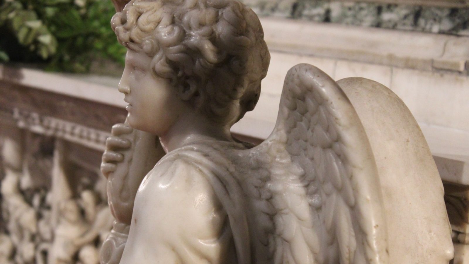
La Galleria delle Carte Geografiche dei Musei Vaticani: l’Italia dipinta nel Cinquecento
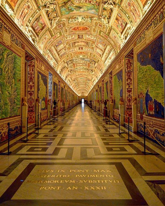
Ai Musei Vaticani, per circa 120 metri, sulle pareti di una lunga galleria, sono dipinti territori, città, montagne, fiumi e coste della penisola così come potevano essere conosciuti e rappresentati alla fine del Cinquecento.
È la Galleria delle Carte Geografiche dove la cartografia diventa pittura e la rappresentazione del territorio si intreccia con la storia, la religione e la cultura dell’epoca.
Il visitatore che percorre questo spazio si trova davanti a un’immensa rappresentazione dell’Italia realizzata quando l’Italia, come Stato unitario, ancora non esisteva. La penisola era divisa tra Stati, ducati, repubbliche, principati e territori sottoposti a potenze straniere, ma sulle pareti della Galleria le sue diverse realtà geografiche vengono riunite all’interno di un unico grande progetto.
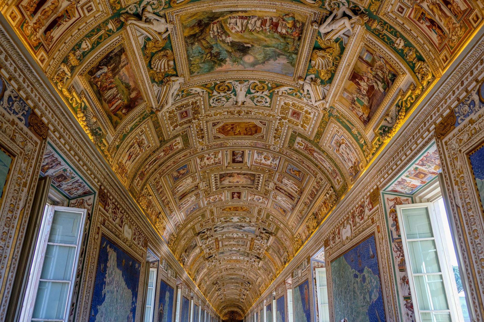
La Galleria delle Carte Geografiche voluta da Gregorio XIII
La costruzione della Galleria venne voluta da papa Gregorio XIII e fu realizzata tra il 1578 e il 1580. L’architettura venne affidata a Ottaviano Nonni, detto il Mascherino, mentre la decorazione pittorica fu eseguita in meno di due anni da una numerosa squadra di artisti coordinata da Girolamo Muziano e Cesare Nebbia.
Per un’impresa di queste dimensioni non era sufficiente organizzare un grande cantiere pittorico. Le immagini dovevano infatti seguire un preciso progetto geografico e iconografico, nel quale la disposizione delle carte, le città rappresentate, le iscrizioni e gli episodi storici fossero coerenti tra di loro.
Il compito venne affidato a Egnazio Danti, domenicano perugino, cosmografo, astronomo e matematico, considerato una delle figure più importanti della cultura scientifica del secondo Cinquecento.
A Danti spettò il compito di elaborare il complesso programma iconografico che avrebbe trasformato il lungo ambiente in una sorta di grande atlante dipinto.
Quaranta mappe raccontano l’Italia del Cinquecento
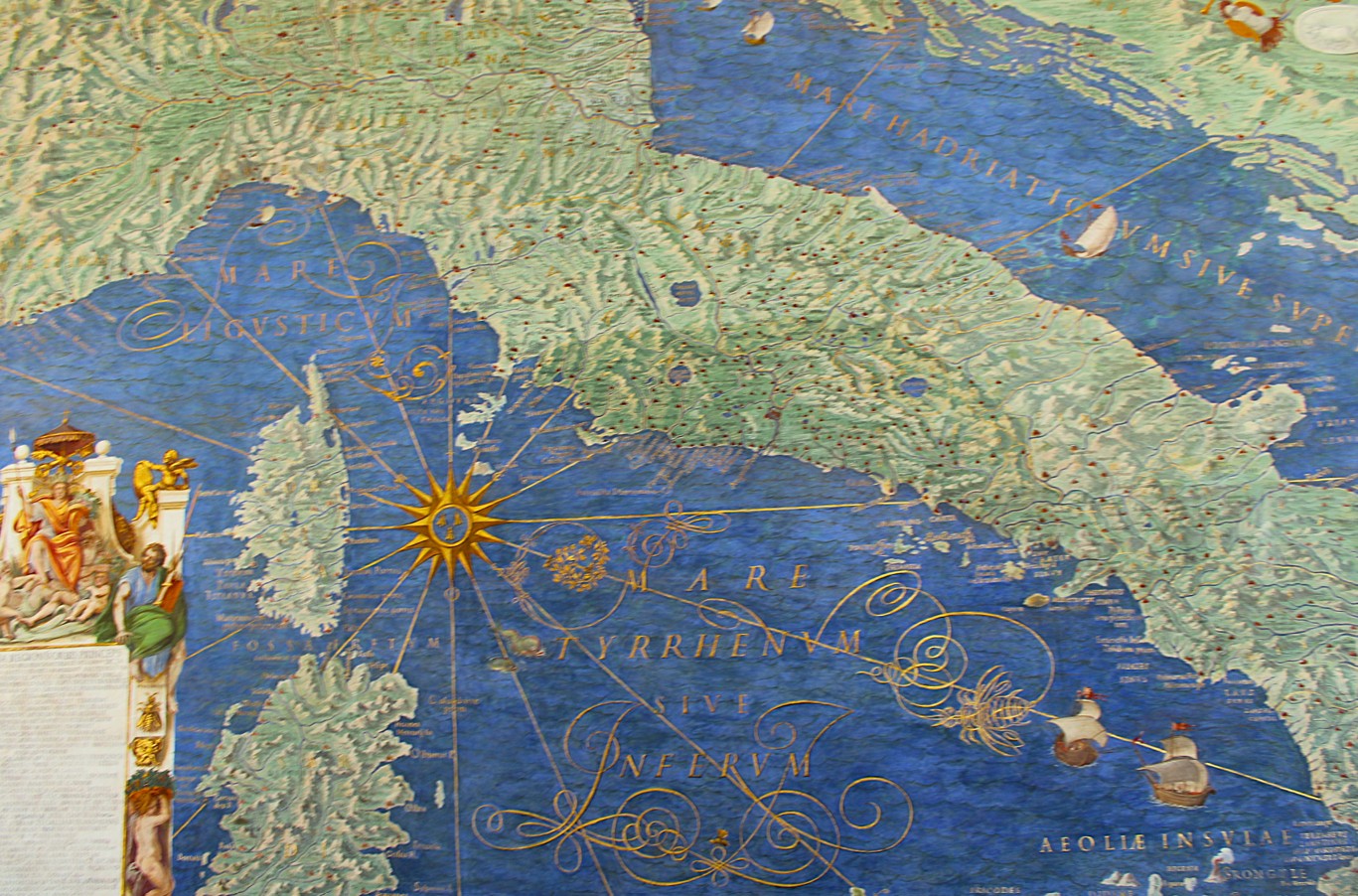
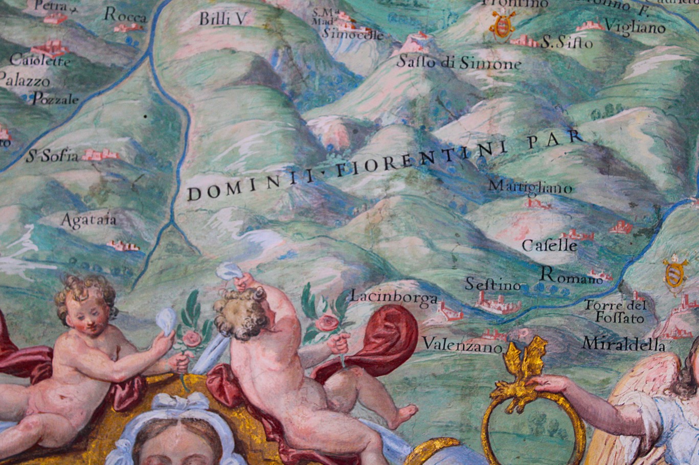
Il nome della Galleria deriva dalle 40 rappresentazioni cartografiche che ne caratterizzano le pareti. 32 carte sono dedicate ai territori italiani e sono disposte secondo una precisa successione geografica.
Percorrendo la Galleria dall’ingresso meridionale, le diverse aree della penisola sono rappresentate idealmente da nord verso sud, con l’Appennino come principale elemento di separazione. Sulla parete rivolta verso il Cortile del Belvedere si trovano le regioni affacciate sul Mar Ligure e sul Mar Tirreno, mentre sulla parete opposta, verso i Giardini Vaticani, sono rappresentati i territori delle Alpi e del versante adriatico.
La disposizione permette di seguire il profilo della penisola mentre si cammina lungo il corridoio. Le mappe però non si limitano a indicare i territori. Danti le arricchì con iscrizioni, piante delle principali città ed episodi storici collegati alle diverse regioni.

Quando la geografia diventa racconto storico
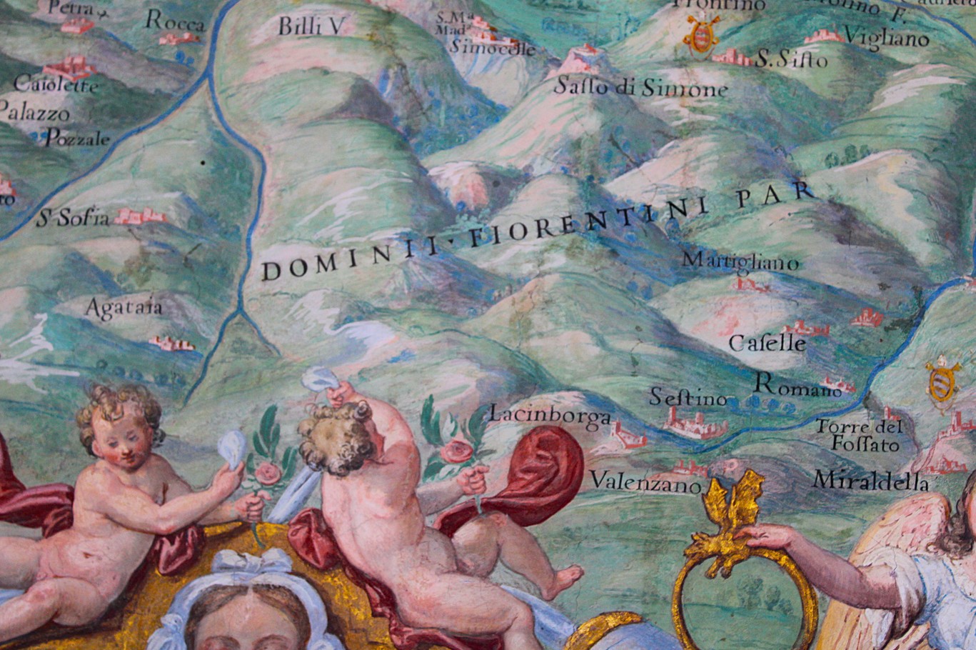
Accanto ai territori affrescati vengono raccontati per immagini riferimenti a episodi importanti della storia antica e moderna. Tra questi si trova la battaglia del Metauro del 207 a.C., nella quale le truppe romane sconfissero quelle cartaginesi, mentre un altro episodio ricorda l’assedio della Mirandola da parte di Giulio II nel 1511.
La scelta di inserire queste scene all’interno delle carte permette di associare immediatamente un luogo alla vicenda che vi si svolse. Le città, i fiumi e i territori diventano così riferimenti concreti per ricordare guerre, personaggi ed eventi che hanno segnato il passato della penisola.
La volta: 51 riquadri sopra le mappe
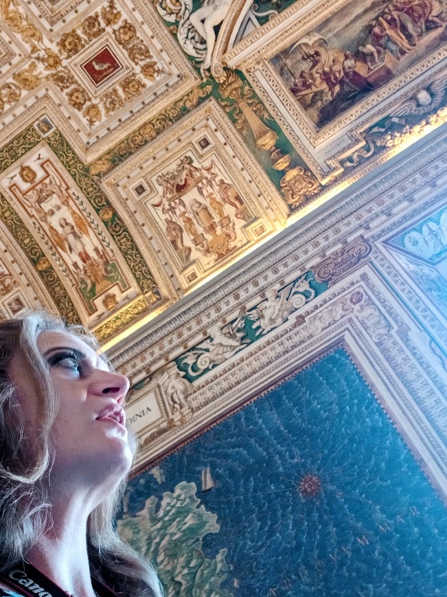
Il progetto di Danti non si fermò alle pareti. Guardando verso l’alto si scopre infatti un’altra parte fondamentale dell’apparato decorativo: la volta è suddivisa in 51 riquadri, inseriti all’interno di ricche cornici in stucco e intervallati da scene dell’Antico Testamento, personaggi biblici e allegorie delle virtù cristiane.
Gli episodi rappresentati sulla volta sono collegati alle regioni che compaiono sulle pareti sottostanti e comprendono avvenimenti della storia della Chiesa e vicende della vita dei santi legate ai territori rappresentati.
In questo modo l’intero ambiente viene costruito come un sistema unitario, nel quale la geografia delle pareti e la dimensione religiosa della volta dialogano continuamente.
Malta, Lepanto e i grandi porti del Mediterraneo
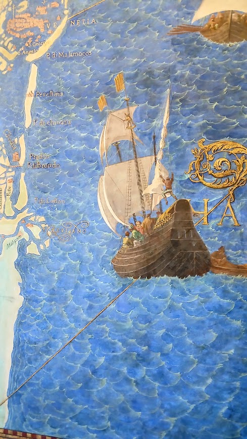
Alle estremità della Galleria si trovano otto carte più strette che completano il percorso. Ai lati dell’attuale ingresso sono rappresentati l’Assedio di Malta e la Battaglia di Lepanto, affiancati rispettivamente dalle rappresentazioni dell’Elba e delle Isole Tremiti.
Sulla parete opposta compaiono invece quattro importanti porti dell’epoca: Civitavecchia, Genova, Venezia e Ancona.
I porti erano nodi essenziali per i commerci, gli spostamenti e le attività militari e la loro presenza all’interno della Galleria contribuisce a sottolineare il ruolo strategico delle coste italiane.
Anche la rappresentazione della battaglia di Lepanto assume un significato particolare, considerando che lo scontro del 1571 era avvenuto soltanto pochi anni prima dell’inizio dei lavori della Galleria ed era stato interpretato dalla Chiesa come un avvenimento di grande importanza politica e religiosa.
Egnazio Danti e l’incontro tra arte e scienza
La figura di Egnazio Danti è fondamentale per comprendere cosa si guarda quando si entra nella Galleria delle Carte Geografiche.
Costruì un programma iconografico impeccabile nel quale cartografia, storia, religione e pittura potessero convivere all’interno dello stesso ambiente.
Danti apparteneva a una cultura nella quale le discipline scientifiche e quelle artistiche non erano considerate necessariamente separate. La rappresentazione accurata del territorio, lo studio delle proporzioni, la conoscenza matematica e astronomica e la capacità di tradurre queste informazioni in immagini facevano parte di un unico modo di interpretare il mondo.
Le mappe hanno una funzione geografica, ma sono anche immagini artistiche; le città vengono rappresentate come elementi topografici, ma diventano anche protagoniste della storia; la volta introduce invece una lettura religiosa che completa quella terrestre delle pareti.
L’Italia prima dell’Unità
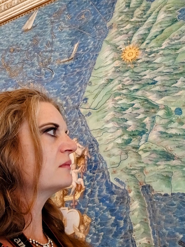
Quando gli affreschi furono realizzati, la penisola era politicamente divisa. Non esisteva ancora lo Stato italiano e le diverse regioni appartenevano a realtà politiche differenti.
La scelta di rappresentare questi territori all’interno di un unico ambiente produce però una visione complessiva della penisola. Le singole realtà mantengono le proprie caratteristiche, ma vengono inserite in una rappresentazione geografica unitaria.
Per questo la Galleria costituisce una testimonianza particolarmente importante della cultura geografica del tardo Cinquecento. Le carte documentano infatti il modo in cui venivano conosciuti e rappresentati i territori, ma mostrano anche come la penisola potesse essere concepita come un insieme geografico, storico, religioso e culturale, indipendentemente dalla sua frammentazione politica.
Il restauro della Galleria delle Carte Geografiche
La Galleria che oggi possiamo ammirare è stata sottoposta a importanti campagne di conservazione. Un grande intervento di restauro, concluso nel 2016 dopo quattro anni di lavori, ha permesso di recuperare la leggibilità delle superfici pittoriche.
Il lavoro ha avuto anche un’importante funzione scientifica, perché le indagini condotte durante il restauro hanno consentito di approfondire la conoscenza delle tecniche, dei materiali e delle diverse fasi di realizzazione delle decorazioni.
La Galleria delle Carte Geografiche dei Musei Vaticani è oggi considerata una testimonianza fondamentale della geografia e della cartografia della fine del XVI secolo.
Per il momento il sempre vostro Michelangelo Buonarroti vi saluta dandovi appuntamento ai prossimi post e sui social.
The Gallery of Geographical Maps at the Vatican Museums: Italy as Painted in the 16th Century
At the Vatican Museums, along the walls of a long gallery stretching for approximately 120 meters, the regions, cities, mountains, rivers, and coastlines of the Italian peninsula are depicted as they were known and depicted at the end of the 16th century.
This is the Gallery of Geographical Maps, where cartography becomes painting, and the representation of the territory is intertwined with the history, religion, and culture of the time.
Visitors walking through this space find themselves before an immense representation of Italy, created when Italy, as a unified state, did not yet exist. The peninsula was divided into states, duchies, republics, principalities, and territories subject to foreign powers, but on the walls of the Gallery, its diverse geographical realities are brought together within a single, grand project.
The Gallery of Geographical Maps commissioned by Gregory XIII
The construction of the Gallery was commissioned by Pope Gregory XIII and was completed between 1578 and 1580. The architecture was entrusted to Ottaviano Nonni, known as Il Mascherino, while the pictorial decoration was completed in less than two years by a large team of artists coordinated by Girolamo Muziano and Cesare Nebbia.
For an undertaking of this scale, organizing a large painting project was not enough. The images had to follow a precise geographical and iconographic plan, in which the layout of the maps, the cities depicted, the inscriptions, and the historical episodes were coherent with each other.
The task was entrusted to Egnazio Danti, a Dominican from Perugia, cosmographer, astronomer, and mathematician, considered one of the most important figures in scientific culture of the second half of the sixteenth century.
Danti was entrusted with the task of developing the complex iconographic program that would transform the long room into a sort of large painted atlas.
Forty Maps Recount 16th-Century Italy
The Gallery’s name derives from the 40 cartographic representations that adorn its walls. Thirty-two maps depict Italian territories and are arranged in precise geographical sequence.
Walking through the Gallery from the southern entrance, the different areas of the peninsula are ideally represented from north to south, with the Apennines as the main dividing line. On the wall facing the Cortile del Belvedere are the regions bordering the Ligurian Sea and the Tyrrhenian Sea, while on the opposite wall, facing the Vatican Gardens, are depicted the Alpine and Adriatic coasts.
The layout allows one to follow the outline of the peninsula as one walks along the corridor. However, the maps do more than simply indicate territories. Danti enriched them with inscriptions, plans of the main cities, and historical episodes connected to the various regions.
When geography becomes historical narrative
Alongside the frescoed territories, references to important episodes of ancient and modern history are depicted through images. Among these is the Battle of the Metaurus in 207 BC, in which Roman troops defeated the Carthaginians, while another episode commemorates the siege of Mirandola by Julius II in 1511.
The choice to include these scenes within the maps allows for an immediate association of a place with the events that unfolded there. The cities, rivers, and territories thus become concrete references to recall the wars, figures, and events that have marked the peninsula’s past.
The vault: 51 panels above the maps
Danti’s project did not stop at the walls. Looking upward, another fundamental part of the decorative apparatus is revealed: the vault is divided into 51 panels, set within rich stucco frames and interspersed with scenes from the Old Testament, biblical figures, and allegories of Christian virtues.
The episodes depicted on the vault are connected to the regions depicted on the walls below and include events from the history of the Church and stories from the lives of saints linked to the territories depicted.
In this way, the entire space is constructed as a unified system, in which the geography of the walls and the religious dimension of the vault are in constant dialogue.
Malta, Lepanto, and the Great Ports of the Mediterranean
At the ends of the Gallery are eight narrower maps that complete the itinerary. On the sides of the current entrance are depictions of the Siege of Malta and the Battle of Lepanto, flanked respectively by representations of Elba and the Tremiti Islands.
On the opposite wall are four important ports of the time: Civitavecchia, Genoa, Venice, and Ancona.
The ports were essential hubs for trade, travel, and military activity, and their presence within the Gallery helps emphasize the strategic role of the Italian coast.
The depiction of the Battle of Lepanto takes on a special significance, considering that the 1571 battle had occurred only a few years before the Gallery’s construction began and had been interpreted by the Church as an event of great political and religious importance.
Egnazio Danti and the Encounter between Art and Science
The figure of Egnazio Danti is crucial to understanding what one sees when entering the Gallery of Geographical Maps.
He constructed an impeccable iconographic program in which cartography, history, religion, and painting could coexist within the same space.
Danti belonged to a culture in which scientific and artistic disciplines were not necessarily considered separate. The accurate representation of the territory, the study of proportions, mathematical and astronomical knowledge, and the ability to translate this information into images were part of a single way of interpreting the world.
Maps have a geographical function, but they are also artistic images; cities are represented as topographical elements, but also become protagonists of history; the vault, on the other hand, introduces a religious reading that complements the earthly interpretation of the walls.
Italy before Unification
When the frescoes were painted, the peninsula was politically divided. The Italian state did not yet exist, and the different regions belonged to different political realities.
The choice to represent these territories within a single space, however, produces a comprehensive vision of the peninsula. The individual realities retain their own characteristics, but are inserted into a unified geographical representation.
For this reason, the Gallery is a particularly important testimony to the geographical culture of the late sixteenth century. The maps document the way in which the territories were known and represented, but they also demonstrate how the peninsula could be conceived as a geographical, historical, religious, and cultural whole, regardless of its political fragmentation.
The Restoration of the Gallery of Geographical Maps
The Gallery we admire today has undergone major conservation campaigns. A major restoration project, completed in 2016 after four years of work, has restored the readability of the painted surfaces.
The work also served an important scientific purpose, as the investigations conducted during the restoration provided a deeper understanding of the techniques, materials, and various stages of the decorations’ creation.
The Gallery of Maps of the Vatican Museums is now considered a fundamental testimony to late 16th-century geography and cartography.
For now, yours truly, Michelangelo Buonarroti bids you farewell and invites you to join him in future posts and on social media.
Sostienici – Support Us
Se questo blog ti piace e ti appassiona, puoi aiutarci a farlo crescere sempre più sostenendoci in modo concreto condividendo i post, seguendo le pagine social e con un contributo che ci aiuta ad andare avanti con il nostro lavoro di divulgazione. . ENGLISH: If you like and are passionate about this blog, you can help us make it grow more and more by supporting us in a concrete way by sharing posts, following social pages and with a contribution that helps us to move forward with our dissemination work.
10,00 €
-
Lo sguardo di San Francesco che emerge dal buio: il dipinto di Annibale Carracci
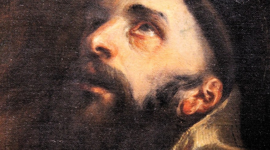
🇮🇹C’è uno sguardo, nel dipinto di Annibale Carracci, che sembra cercare qualcosa oltre ciò che possiamo vedere: è quello di San Francesco d’Assisi, ritratto con gli occhi rivolti al cielo… 🇬🇧In Annibale Carracci’s painting, there is a gaze that seems to be searching for something beyond what we can see: it is the gaze of…
-
La Cacciata dei mercanti dal Tempio: quel disegno che forse nasconde un progetto incompiuto
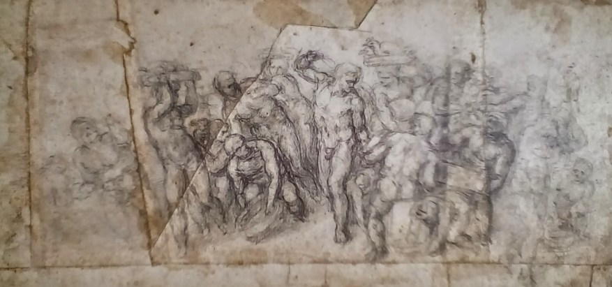
🇮🇹Vi porto davanti al mio disegno della Cacciata dei mercanti dal Tempio, conservato al British Museum. Guardate il braccio destro di Cristo: la forza del suo gesto vi ricorda qualcosa? 🇮🇹 I am bringing you before my drawing of the Expulsion of the Money Changers from the Temple, held at the British Museum. Look at…
-
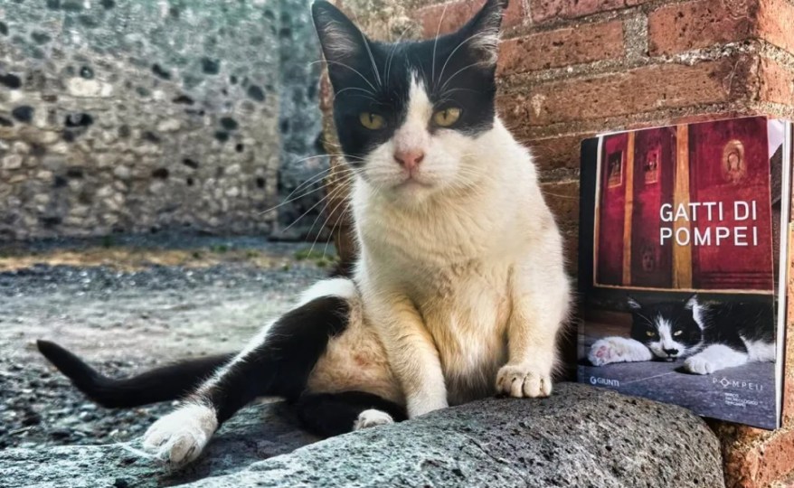
A Pompei ci sono 50 gatti che vivono tra le rovine antiche: ora la loro storia diventa un libro
A Pompei i gatti sono diventati celebri sui social. Ora il libro Gatti di Pompei racconta, con foto e storie, la loro vita tra le antiche rovine romane.
Condividi:


Questo sono io



sostienici

Sostienici – Support Us
Se questo blog ti piace e ti appassiona, puoi aiutarci a farlo crescere sempre più sostenendoci in modo concreto condividendo i post, seguendo le pagine social e con un contributo che ci aiuta ad andare avanti con il nostro lavoro di divulgazione. . ENGLISH: If you like and are passionate about this blog, you can help us make it grow more and more by supporting us in a concrete way by sharing posts, following social pages and with a contribution that helps us to move forward with our dissemination work.
€10,00


1 commento »